The ground is one thing, as far as any blueprints are drawn or as this first foundation is put down. Assessments of the risks in the landscapes should cease to be optional. They should come first in every construction work nowadays. Even the most carefully planned buildings can be betrayed by unstable soil, hidden waterways, and seismic weak spots without the owners of such properties knowing anything about these issues. As climate change increases uncertainty, it becomes crucial to understand what is happening underneath. The fact that smart terrain appraisals stop the expensive failures isn’t the only benefit; they also allow constructors to build safer, more resilient structures at the ground level.
Building Begins Beneath the Surface
This section focuses on how understanding geology and subsoil conditions prevents structural flaws and ensures proper foundation alignment from day one.
Soil Classification Shapes Design Choices
Instead of pure identification of risk, the latest terrain checks would assist an engineer in the selection of types of foundations, reinforcement depth, and ground treatment on the basis of an exact soil profile. It is not only the avoidance of collapse, but the development of the proper development. The right materials and supporting tools are easy to choose with detailed soil classification, and allow a structure to remain strong in the weather.
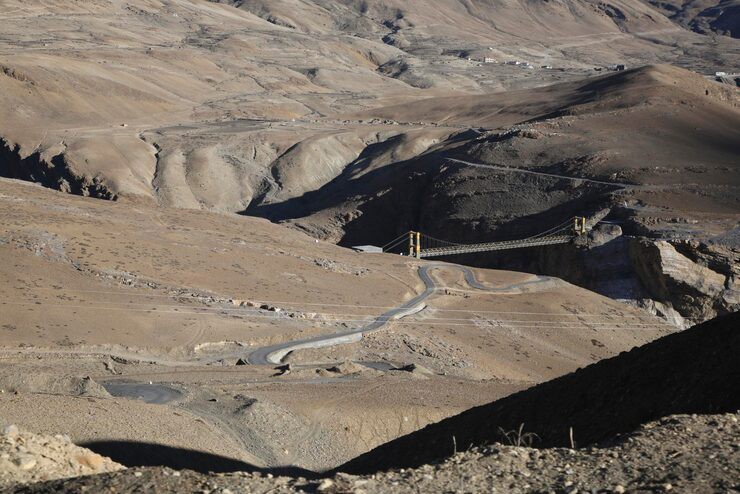
Unstable Slopes Require Preemptive Intervention
Landslides are risky in areas that are close to cliffs or hills, or embankments. Terrain analysis indicates which areas have to be anchored or held up by the retaining structure, many months before heavy machinery does. Weak spots on the slope are also pointed out early, before having to redesign the slope halfway in the process of the construction process.
Water-Logged Zones Undermine Foundations
Structures are made unstable due to poor drainage and the presence of pockets of underground water. Risk checks assist in formulating decisions regarding the extent of excavations, drainage structures, and sealing the base. Identification of the water flow patterns will also eliminate the occurrence of erosion in the future under the slab and footings.
Earthquake Zones Need Custom Foundation Strategy
Seismic-prone areas require terrain checks to guide anti-vibration design.
- Maps liquefaction zones
- Suggests shock-absorbing materials
- Guides deep anchoring or base isolation methods
These assessments allow engineers to create structures that flex and absorb shocks rather than fail under seismic load.
Terrain Data Enables Smarter, Safer Design
In this unit, we examine how smart data is not only the ability to mitigate risk, but also how it can enhance planning, minimize cost, and enhance long-run safety by using terrain knowledge.
Satellite Mapping Adds Historical Perspective
Data gathered by multi-year satellites demonstrates consistent erosion, movement of the land, and fault migration. It enables groups to miss land with a concealed legacy of instability. When we see data, we can make better decisions on where to locate new buildings and roads, particularly in expanding cities.
Predictive Modeling for Climate-Resilient Design
Predictive terrain modelling looks at the reaction of soil and underground forms to the influence of environmental stressors, e.g., drought, flooding, or heat waves. The advantage of such simulations to engineers is the proactive advantage that results in building designs that are more sensitive to climate variability. The outcome is more intelligent planning, which considers the changes in the environment in the long term without even commencing the construction work.
Terrain Classification Affects Permit Approvals
Sensitive zones are making documentation about geomorphology in cities increasingly necessary. A terrain assessment enables faster compliance and prevents the planners not getting on the wrong foot with the regulatory changes. Proper reports also minimize costly corrections on the grounds of unexpected geological objections.
Verified Terrain Data Lowers Insurance Risk
When developers have certified terrain profiles, they can leverage their points when negotiating with insurers. The fewer that remain unknown, the lower the premiums, and the more thorough the preparation, the fewer liability disputes. Terrain data is transformed to be used as a negotiation tool, not merely possessing technical reading.
Closing Thoughts
Every safe structure has an informed decision-and informed decision begins with the ground. Checks of terrain risk are not a luxury or a formality anymore. They form the basis of resiliency, accuracy, and cost effectiveness. Knowing the behavior of soil, water patterns, and seismic sensitivity, no builder can suffer the setback that never lands on the headlines because it never occurs.
Conclusion
When you do what you know about the land, you dictate the result. Build Safe Up enables teams to make safer, smarter decisions in the first place. Most of the constructions are based on hypotheses and give way to wrong assumptions or mistakes. The most relevant and effective models are, however, constructed out of careful understanding and intelligent consideration.